Last updated on 2011.01.30

Why yes, Secretary Pirner, that is pretty cool!
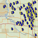
The Department of Environment and Natural Resources has plugged its recent historical database of South Dakota lake levels into an online interactive map. You can now click on your favorite lake and find out its ordinary high water mark, outlet elevation, and measured lake levels back to 1981.
Click on Lake Herman, for instance, and you'll learn that our normal high-water mark here at 43.994212°N 97.176908°W is 1669 feet above mean sea level. You'll also see that the lake level recorded last May of 1673.05 feet was the highest mark DENR recorded since 1984 (they should have sent the guy with the measuring stick in July 1993). I'm looking at the snow piled on the ice this winter and thinking we might match that mark come April.
Now if we could just hook that map up to some live fishcams and float gauges....
