But maybe Gordon and Lynne are right: maybe America is falling away from the faith, and God is punishing us by bombarding the prairie with rain and hail and tornadoes.
Nah, I'm still putting my money on climate change and bad agricultural practices.
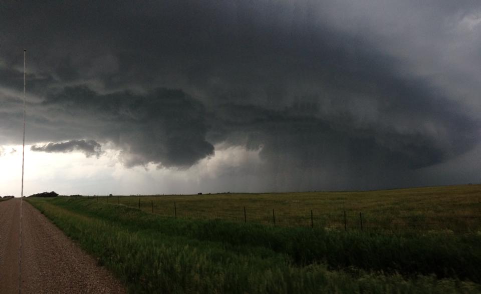
Whatever the cause, Madison storm chaser Ashley Kenneth Allen is out documenting nature's rampage. He sends the following pix and presser relating his experience with the tornadic thunderstorm out in Jerauld and Sanborn counties last night:
Local storm chaser Ashley Kenneth Allen covered the tornadoes that impacted the Wessington Springs, SD area on Wednesday night. Allen, along with chase partner Pat Routier, arrived in the Gann Valley just as the first tornado warning was being issued by the National Weather Service.
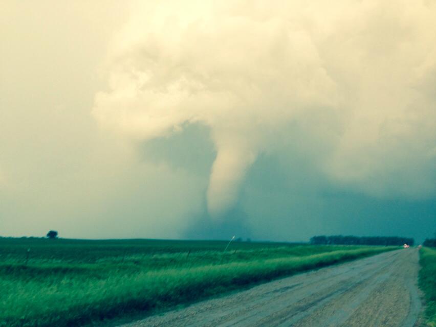
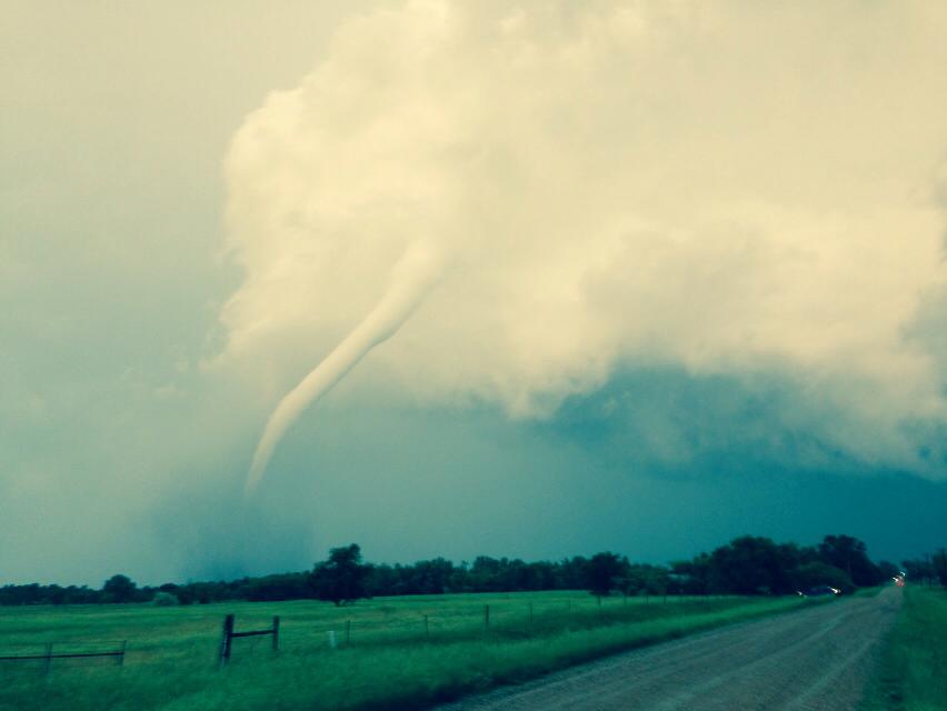
At that time, the first tornado of the night was west of Wessington Springs. The tornadic thunderstorm had produced multiple areas of circulation and a tornado had dropped and lifted multiple times. As the storm came into the town of Wessington Springs, Allen and Routier were positioned on the southern tip of the storm where a new area of circulation, wall cloud and funnel had formed, approximately 5-6 miles south of Wessington Springs. They streamed live video and provided phone reports of the tornadoes to KSFY, KELO, and the Weather Channel as they watched a rain wrapped tornado go through Wessington Springs.
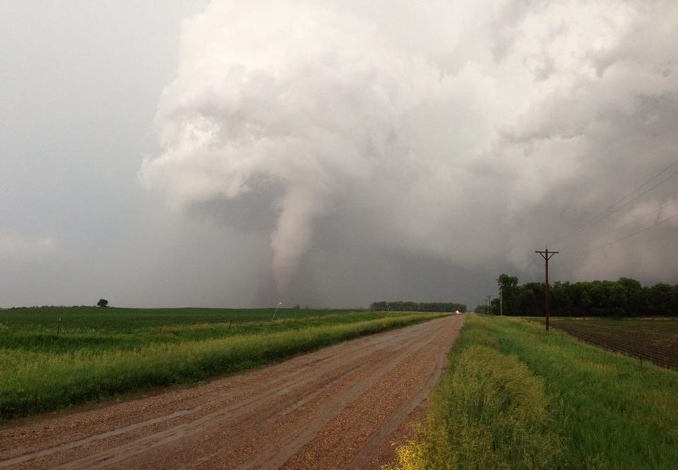
Moments later, the new tornado formed that would go west of Woonsocket and the team followed it to Lane. The tornado had multiple vortices and became just as dangerous as the first tornado that went through Wessington Springs. The chasers continued to provide live video and phone reports as the wedge tornado destroyed a farm on the west side of Alpena and came within only a few blocks of Alpena. Luckily, the tornado "roped out" and died just moments before going through Alpena.
The team is not able to confirm exactly how many tornadoes there were last night, as there were many different vortices in the parent tornado and multiple areas of rotation in this tornadic mesocyclone thunderstorm.
Allen said "The destruction in Wessington Springs is devastating, but I am glad we were able to work with local media and the NWS to give everyone a 15-20 minute lead time to take shelter. No one died in Wessington Springs and I credit the team effort of storm chasers, local media, the NWS, and emergency management."
Allen is the co-founder of SevereStudios Inc. and is the creator of Severe Situation, a severe weather awareness and preparedness project from Ashley Kenneth Allen LLC [SevereStudios, Inc., press release, 2014.06.19].
Geez. Terrible. MN is 10 inches above normal at this time and has widespread flooding. How is SD doing with this weather. Flooding? Emergency or Disaster counties? This is getting seriouser and seriouser. Thank god it's not global warming! :-P